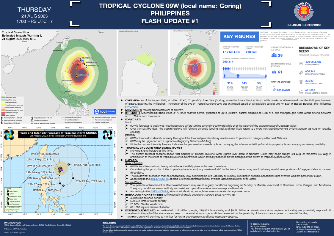
FLASH UPDATE #1 – Tropical Cyclone 09W (Goring)
Country under monitoring: Philippines
OVERVIEW:As of 24 August 2023, at 1600 UTC+7, Tropical Cyclone 09W (Goring), intensifies into a Tropical Storm while moving northwestward over the Philippine Sea east of Basco, Batanes, the Philippines. The centre of the eye of Tropical Cyclone 09W was estimated based on all available data at 265 km East of Basco, Batanes, the Philippines (PAGASA).
MOVEMENT: Moving Northwestward at 10 km/h.
STRENGTH: Maximum sustained winds of 75 km/h near the centre, gustiness of up to 90 km/h, central pressure of 1,000 hPa, and strong to gale-force winds extend outwards up to 170 km from the centre.
FORECAST:
Track
- 09W is forecast to track west-southwestward before turning generally southward while over the waters of the eastern coast of Cagayan Valley.
- Over the next five days, the tropical cyclone will follow a generally looping track and may likely return to a more northward movement by late Monday (28 Aug) or Tuesday (29 Aug).
Intensity
- 09W is forecast to steadily intensify throughout the forecast period and may reach severe tropical storm category in the next 36 hours.
- 09W may be upgraded into a typhoon category by Saturday (26 Aug).
- While the current intensity forecast indicates the progression towards typhoon category, the inherent volatility of attaining super typhoon category remains a possibility.
TROPICAL CYCLONE WIND SIGNAL (TCWS):
- No Wind Signal hoisted at this time.
- The current forecast scenario shows that hoisting of Tropical Cyclone Wind Signals over areas in Northern Luzon may begin tonight (24 Aug) or tomorrow (25 Aug) in anticipation of the onset of tropical cyclone severe winds which critically depends on the changes of the extent of tropical cyclone winds.
HAZARD:
Heavy Rainfall
- 09W is less likely to bring heavy rainfall over the Philippines in the next three days.
- Considering the proximity of the tropical cyclone to land, any westward shift in the track forecast may result in heavy rainfall over portions of Cagayan Valley in the next three days.
- The Southwest Monsoon may be enhanced by 09W beginning on late Saturday or Sunday, resulting in possible occasional rains over the western portions of Luzon.
- According to the ASEAN DMRS, at most 610 mm estimated tropical cyclone-associated rainfall over Luzon.
Severe Winds
- The possible enhancement of Southwest Monsoon may result in gusty conditions beginning on Sunday or Monday over most of Southern Luzon, Visayas, and Mindanao. The gusty conditions are more likely in coastal and upland/mountainous areas exposed to winds.
- According to the ASEAN DMRS, at most winds strong enough to cause moderate damage over Luzon.
BREAKDOWN OF KEY NEEDS (Of exposed vulnerable population, source: DisasterAWARE):
- 420 million calories per day
- 600,941 litres of water per day
- 20,033 100-liter waste bins
- 691,082 square metres of shelter
EXTENDED FORECAST: An estimated 1.17 Million people, 278,563 households, and $8.27 Billion of infrastructure (total replacement value) are potentially exposed. All shorelines in the path of the storm are exposed to potential storm surge, and inland areas within the proximity of the storm are exposed to potential flooding.
The AHA Centre will continue to monitor for further developments and issue necessary updates.
DATA SOURCES:
ASEAN Disaster Monitoring & Response System (DMRS);
Philippines: NDRRMC, PAGASA;
Verified news media agencies.


